


Principales ventajas
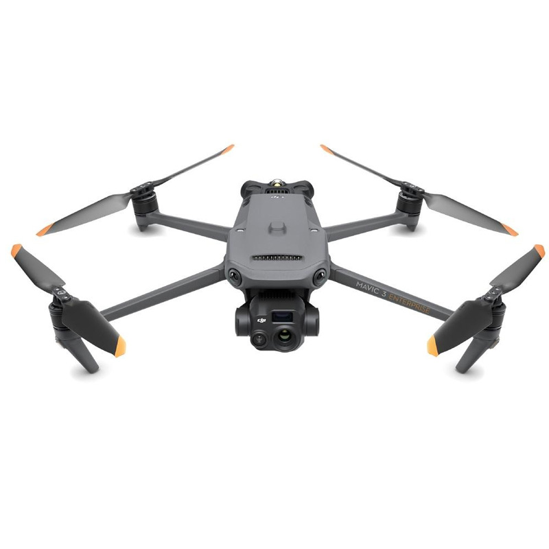
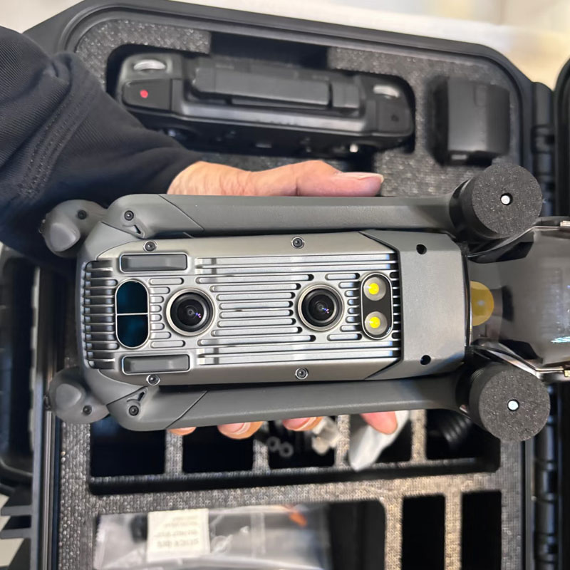
Sistema de imagen de triple cámara
- ✔
Cámara gran angular de 48 MP: Sensor CMOS de 1/2″ con distancia focal equivalente a 24 mm, que ofrece imágenes ultra nítidas para cartografía de grandes áreas e inspección industrial diurna. - ✔
Teleobjetivo de 12 MP: Distancia focal equivalente a 162 mm con zoom híbrido de 56×, perfecto para la observación de objetivos a larga distancia y la inspección precisa de componentes. - ✔
Cámara termográfica 640×512: Sensor VOx no refrigerado con distancia focal equivalente a 40 mm. Admite medición de temperatura puntual y de área y alarmas de alta temperatura, ideal para detección de incendios, búsqueda y rescate nocturnos e inspección de equipos sobrecalentados.
Operaciones inteligentes basadas en IA
- ✔
Detección inteligente de objetivos: Identifica automáticamente personas, vehículos y embarcaciones, con soporte para la personalización de algoritmos de terceros para escenarios industriales especializados. - ✔
Flujo de trabajo colaborativo: Se sincroniza a la perfección con DJI Sky 2 para permitir misiones coordinadas de varios drones, eliminando tareas repetitivas y aumentando la eficiencia operativa general. - ✔
Precisión RTK a nivel centimétrico: GNSS multisistema integrado con GPS, Galileo, BeiDou y GLONASS, que cumple las normas de precisión de los sistemas profesionales de topografía y cartografía.
Rendimiento de vuelo portátil y fiable
- ✔
Tiempo máximo de vuelo 45 min: Hasta 45 minutos de autonomía estándar, cubriendo amplias zonas en un solo vuelo para misiones de inspección y vigilancia. - ✔
15km O3 Enterprise Transmission: El sistema de señal adaptativa de 8 antenas mantiene una conexión estable en cañones urbanos y terrenos complejos, con respaldo de señal 4G. - ✔
Sorteo de obstáculos en 360°: Equipado con 6 sensores ojo de pez de baja luminosidad para evitar obstáculos de forma automática y fiable por la noche y en entornos de construcción complejos. - ✔
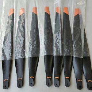
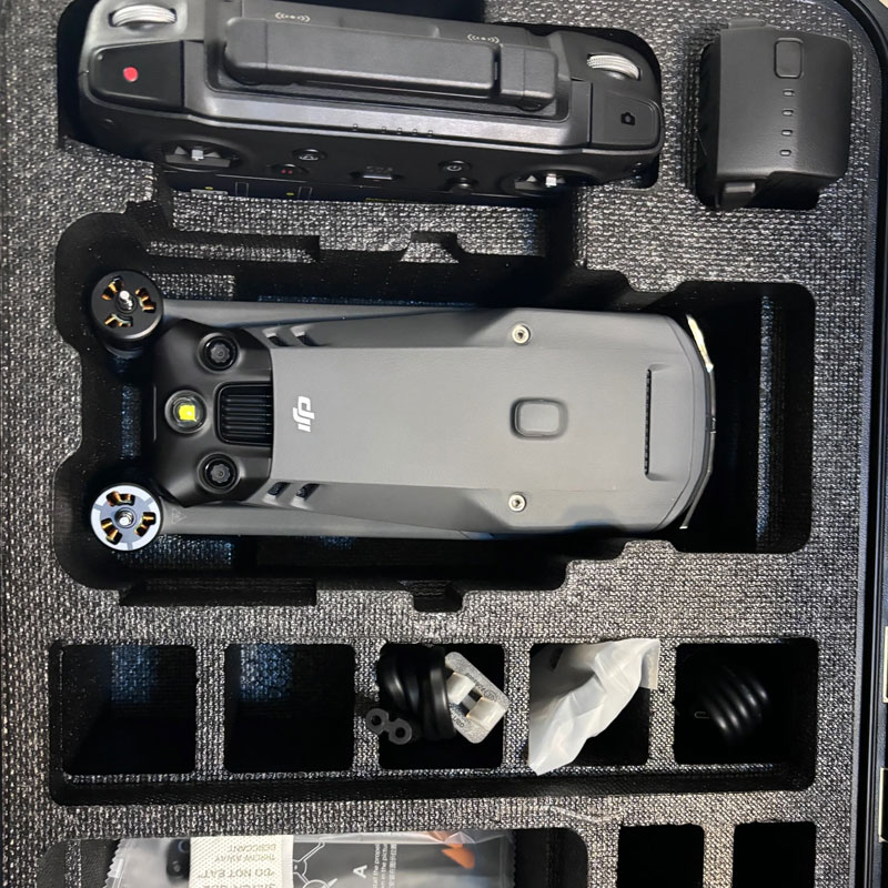
Diseño ligero y plegable: Sólo 920 g de peso neto con hélices; tamaño plegado 221×96,3×90,3 mm, fácil de transportar por una sola persona y de despliegue rápido.
Escenarios de aplicación
- •
Seguridad pública: Búsqueda y rescate, seguimiento de sospechosos, control de multitudes, vigilancia nocturna, detección de incendios forestales - •
Potencia y energía: Inspección de líneas de transmisión, vigilancia de subestaciones, patrulla de parques eólicos y solares - •
Respuesta de emergencia: Evaluación de catástrofes, control de inundaciones, rescate tras catástrofes y cartografía de incendios forestales - •
Construcción e infraestructuras: Inspección de edificios, detección de defectos en puentes, control del avance de las obras - •
Silvicultura y protección del medio ambiente: Detección de talas ilegales, prevención de incendios forestales, vigilancia de embalses y vigilancia ecológica
Especificaciones técnicas
Peso de despegue: 1050g Peso máximo al despegue / 920g Peso neto (con hélices)
Dimensiones plegado: 221×96,3×90,3 mm (sin hélices)
Velocidad máxima de vuelo: 21 m/s a nivel del mar, sin viento (modo Sport)
Resistencia al viento: Hasta 12 m/s
Temperatura de funcionamiento: -10°C a 40°C (14°F a 104°F)
GNSS: GPS + Galileo + BeiDou + GLONASS, compatible con posicionamiento de alta precisión RTK
Sistema de cámaras: Gran angular de 48 MP + teleobjetivo de 12 MP + cámara termográfica de 640×512
Capacidad de zoom: Zoom híbrido de 56×
Evitación de obstáculos: Visión completa de 360° con 6 sensores de ojo de pez con poca luz
Resistencia: Hasta 45 minutos de vuelo estándar
Transmisión de imágenes: Transmisión O3 Enterprise, 15 km de largo alcance
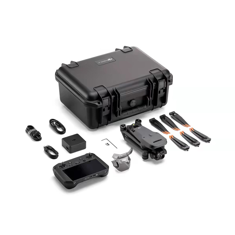
Accesorios opcionales
- - Estación base multifunción DJI D-RTK 3
- - Amplificador de voz en tiempo real (110 dB, alcance efectivo de 100 m)
- - Módulo amplificador de señal 4G
- - Batería inteligente de alta capacidad
- - Tarjeta MicroSD de alta velocidad U3 de 64 GB / 128 GB
- - Juego de hélices silenciosas